31 March 2011

Running & Walking in London UK

March 2011

Spent a few days in London, UK. The weather was warm, closing up to +18C with sunny spells. Daffodils and other flowers were blooming, cherry trees were fully pink and other trees started to get small leaves. In other words, Spring was in the air, heavily.

Ran on a couple of days, on Green Park, St James' Park and Hyde Park. Walked one day from Southwark to Mayfair.

BBC and others had already started to build temporary constructions near the Buckingham Palace due to becoming weddings. Has to be a big happening in the town.

Flowers blooming in front of
the St Paul's Cathedral

Daffodils in Green Park

St James Park and Big Ben 

Cherry tree in St James Park

It's ten past six says Big Ben

My favorite traffic light in London,
Hold On Your Horses!

Hey! What about pedestrians?

Here's the running route on day 1 (View Larger Map):


Here's the running route on day 2 (View Larger Map):


Here's the walking route on day 3 (View Larger Map):

27 March 2011

Hiking in Nuuksio National Park, Finland

March 2011

Made a brave decision this morning (Sun 27th); instead of watching F1 premiere GP of this season from TV, headed to Nuuksio National Park. Did a 17km hiking around the small lakes via hiking paths.

The sun shined although not brightly, temperature stayed under zero centigrades and wind was brisk. Had hot coffee in thermo and rye bread sandwich with me. Enjoyed the last real winter days in the middle of the forest. There's still about 2ft of snow. Amazing that it's now the end of March and we have a full winter in the south of Finland.

Saw a big bird flying, heading towards north. Not sure but to me it was a swan (alternative: crane)?

Here's the hiked route (View Larger Map):


A thick formation of ice

A small pond, Niemelänlampi

Do-it-yourself-wood logs

Someone told me its a Lynx?

Pine woods are beautiful late winter

Nice formation

A Lady with a hat

A rock at Vähä-Holma pond

A grip provided by nature, dead needles

A view to Lake Haukkalampi

23 March 2011

Hiking Monte Lema - Monte Tamaro, Ticino CH

June 2003 & July 2007

This is the second Ticino (Tessin) based hiking route that I've added to my blog. It is also a one day hiking route (almost 15km). I've done it twice.

I've included some photos from my first hike there. During the 2nd visit there I didn't even carry a camera with me as I tried to run it through (how stupid, I know). There are lots of photos available from these mountains, just google/bing them.

Monte Lema - Monte Tamaro  (or vice versa)

It is a well known hiking route located in southern part of Ticino canton in Switzerland. It is sometimes  called a peak-to-peak route, as it goes almost only on top of the mountains, staying on the ridges almost all the way. These mountains are basically the last big mountains when going south towards Milano in Italy. MySwitzerland.com advertises this route as "Nowhere else can such views be found. This ridge walk from Monte Lema to Monte Tamaro is a classic amongst the Swiss high altitude hikes. The panoramic view is unbeatable".

The hiking route is rated as T2, or usually T3, depending on the actual route (short information about ratings in www.hikr.org. Ratings are defined by Swiss Alpine Club).

There are some alternatives of how many mountain peaks one would like to follow. The route I've done is perhaps the most common, containing eight peaks altogether.

The peaks are (from south to north): 
    Monte Lema (1627m)
    Poncione di Breno (1654m)
    Zottone (1569m)
    Monte Magno (1636m)
    Monte Pola (1742m)
    Monte Gradiccioli (1935m)
    Monte Tamaro (1961m)
    Alpe Foppa (1530m)


Here's the route (View Larger Map):


The scenery throughout the route is spectacular. Monte Lema advertises its peak to be the best for 360 degrees scenery on this neighborhood. Nothing against that. The best view is typically on a sunny day immediately after the rain when the air is clear (usually during the summer months visibility in long distance is not so good).  The route is also vulnerable for wind due to its openness.

The hiking route starts from the top of Monte Lema (1624m). The peak can be reached from Miglieglia (717m) village (now belonging to Malcantone region), either by climbing up from there or taking a lift (Funivia).

A view to north from Monte Lema

The path is clearly visible, and also marked on some stones along the route (painted white-red-white stripes).

White-Red-White markings along the route

Some steep sections ...

... but not too dangerous


If you think that the route is easy from Gradiccioli to Tamaro, you're wrong, as the route goes a bit down from Gradiccioli down to 1764m level (Bassa di Montoia) and stays in that level until Bassa di Indemini (1723m) where it starts to climb in a short distance until to the top of the Tamaro.


The last sprint ...

... but not quite yet

Aah, finally there, but ...

After reaching the peak of Monte Tamaro, the route still continues some kilometers ascending to Alte Foppa (despite the name of the route suggests to finish here). 

Locarno and Ascona and Lago di Maggiore

Sometimes clouds stop visibility

The final destination is Alpe Foppa (1530m), where the lifts from Rivera are ending. Alpe Foppa area used to be the south most ski resort, known as "Monte Tamaro" (I came here several times some years back). There is one important sightseeing in there, Cappella di Santa Maria degli Angeli, a chapel designed by Mario Botta.


These fellows enjoy a beautiful scenery even at lunch time

Lessons Learnt:
  • Not opened on winter months, check e.g. Monte Lema site
  • Check when the lifts are active for Monte Lema and especially Rivera-Alte Foppa (Monte Tamaro)
  • Check bus timetables between Rivera and Miglieglia
  • If you decide to hike from Alte Foppa to Rivera, after the ascent one has to cross the highway (Autostrada) to get Rivera and this crossing makes hiking path clearly longer  
  • There are no places to get fresh water after the Cafe on the peak of Monte Lema. Thus it is important to carry enough water with you.
  • SwissTopo hiking maps (1:25000) useful


19 March 2011

Hiking in Lucomagno, Ticino CH

July 2008

I add some old stuff into my blog, starting by some easy hiking routes in Ticino (Tessin auf Deutsch) canton of Switzerland which I've hiked. This is the first one:

Passo del Lucomagno - Passo dell'Uomo - Capanna Cadagno - Passo del Colombe - Passo del Lucomagno

This is a one day hiking route that I've done several times during the past 20 years. It is a high altitude route (sentiero alto) but fairly easy as it stays on level from 1900m  to 2400m (several up and downs). As it is in about 2000m above sea, it is also treeless (and breathtaking!).

In such an altitude in the Alps, risk of rapidly changing weather conditions should be taken into account, even in summer time. Although I've done it always during Jun-Aug, one time I was hit by a heavy snowstorm, bringing about 30cm new snow in July. About maps; I use 1:25000 scale of Swisstopo maps.


Here's the route:


Basically the route can be started from two places which can be reached by car/bus; from a Lucomagno Pass (Valle di Blenio) or from Ambri-Piotta taking first a funicular up to mountain (Valle Leventina). I've always started from Lucomagno Pass (or Passo del Lucomagno to me), reached by car.

Hospezi Santa Maria on Passo del Lucomagno

Starting (1915m above sea level) the route from the parking lot (they've added park meters there!), the first two km is on a sand road, following the south side of the artificial lake. The first goal is to climb slowly via hiking path full of stones to Passo dell'Uomo (2218m). Pizzo dell'Uomo (2662m), the top, is on the left hand side. Better to have good hiking boots for not to twist your ankles on those stones/rocks. After the pass, the path starts to go down slowly.

Hiking route from the artificial lake to Passo dell'Uomo

After some 1km the route splits into two, the left hand goes to Passo delle Colombe (2381m)/Passo del Sole (2376m), and the right hand path continues all the way through Val Piora towards Lago Ritom (1850m) and Lago Cadagno (1921m), two very nice alpine lakes. I've usually hiked until a small hut, Capanna Cadagno (1964m), near the lakes (another good picture showing its location).

A small waterfall in Val Piora

The path from the split until the hut follows very near the river. Cow bells and marmots are the only ones whose sound one can hear there. Once reaching the Capanna Cadagno, it is time to have a lunch break. Polenta, country cheese and salami, all home made, with some local red wine (Merlot), are all good choices (another good view from the place).
Circling both lakes would increase distance and time quite a lot, so following the same path back has mostly been my choice. Also, if there's time and power, climbing to Lago di Dentro (2298m) is worth of doing (about 500m ascending vertically).

Val Piora towards San Gottardo 

Then to return following the same hiking path in Val Piora back to the point where the path from Passo dell'Uomo split. Here to take the path towards Passo del Colombe. The path goes gently uphill towards the pass (from 2174m to 2381m in about 2-3km distance).

Pizzo Colombe

If the wind is not too strong, Passo del Colombe (2381m) is a good place to rest awhile before starting descent. There's some bench and a table for enjoying some food.

Time estimates are valuable information

Descend from Passo del Colombe is first quite steep, at this point of the hike you'll notice it in your legs. Then the path comes to quite flat part. This is really nice area, called Piano dei Canali. You can see big snow top mountains towards Greina (east direction).

Piano dei Canali

Pizzo Colombe from Piano dei Canali

After the flat route comes a tricky part to descend to the valley. Lots of stones and rocks. After rocky section starts the green area. The path goes down near Brenno river. However, the river goes like in a canyon, thus staying off from it in some distance is a good idea. Very soon you can see Passo del Lucomagno on your left hand side (about 2-3km to go).

Brenno river down in the canyon. The road towards Lucomagno

The rest of the route is to follow close to the Brenno river back to Lucomagno.

Artificial lake at Lucomagno

13 March 2011

Sunday Walk around Laajalahti Bay, Helsinki/Espoo Finland

March 2011

Did a Sunday walk around Laajalahti Bay, about 14km. Yesterday promised sun shine was changed to a very cloudy day.

Laajalahti Bay is surrounded by the cities of Helsinki and Espoo. Around the Bay, there are some real pearls; Laajalahti Nature Reserve area with Villa Elfvik and Gallen-Kallela & Didrichsen museums. Didn't stop these at this time.

While crossing the Nature Reserve, was looking for any signs about early Spring. Certainly areas of open water were increased, being now much larger than last Sunday, e.g. near every bridge. Birds were singing, although didn't recognized other than Great Tit, which all sang fiercely. Pussy willows reminded Easter time coming.

All in all about signs for Spring: some sings yes, but still mostly yet to come.

The route:


Bolted

An occupant waiting to be able to circle the pole

Pussy Willows, Spring's here !

A Bridge Over Troubled Water

Usually on summer high reed beds block the view to the Bay

Still the fastest way to progress on ice today

12 March 2011

Hiking on Lemmenjoki National Park, Lapland Finland

August 2010

Did a three day hiking trip on Lemmenjoki National Park with two other fellows on mid August 2010. The weather was still amazingly warm and what was more strange was the fact that there were practically no mosquitoes at all. Brilliant!

Our plan was to see some gold mining in practice, as Lemmenjoki area was known still perhaps the most important area in Finland for private gold searching, by hand and by motored equipment (as writing this blog now in March 2011, Finland's Government extended gold mining Act in this region by 9 years). Striking fact was that there were practically no roads in the National Park for gold searchers. Thus in practice they had had to carry all equipment there with snow mobiles during winter time.

We had reserved some cabins and therefore didn't have to carry tents in backpacks. There was in fact a well marked route that one had to follow carefully while hiking (usual restriction in National Park).


Prologue

Arrived at Ahkun Tupa cottage in the evening by car. Booked a small cottage and had a dinner at the Bar. Enjoyed the usual Reindeer Stew, with mashed Lapland potatoes and Lingonberries, yummy !
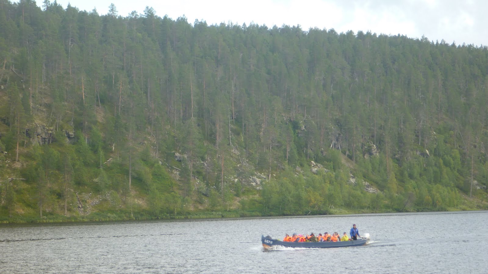
Booked seats to the boat taxi, which would carry us tomorrow some 10 miles along with Lemmenjoki River, where the hiking would start.


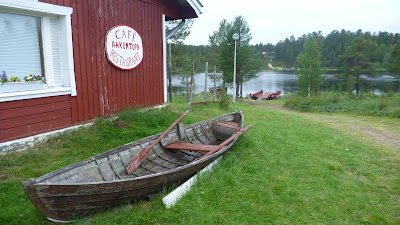
Ahkun Tupa, a legendary place 


Day 1

Early breakfast at the Bar of Ahkun Tupa, and then started to wait the boat trip. The boat had seats for about 20 people and it came full of eager hikers. During the boat trip, we had to step out from the boat and walk a bit due to low water in the Lemmenjoki River.  The boat stopped a couple of times, leaving people on and off board. Previous stop before the finish we stopped to see a nice waterfall.  Overall the boat trip took about 1h 30mins, carrying us about 17km.

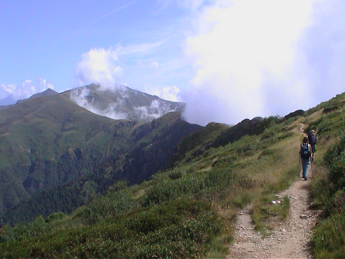
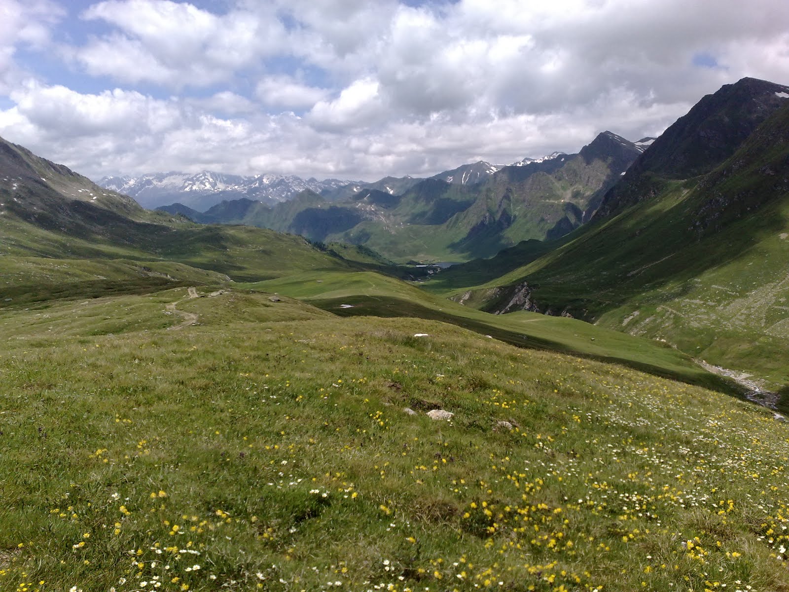
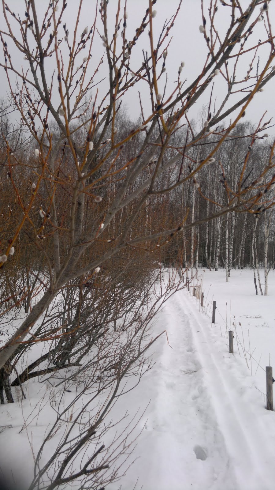
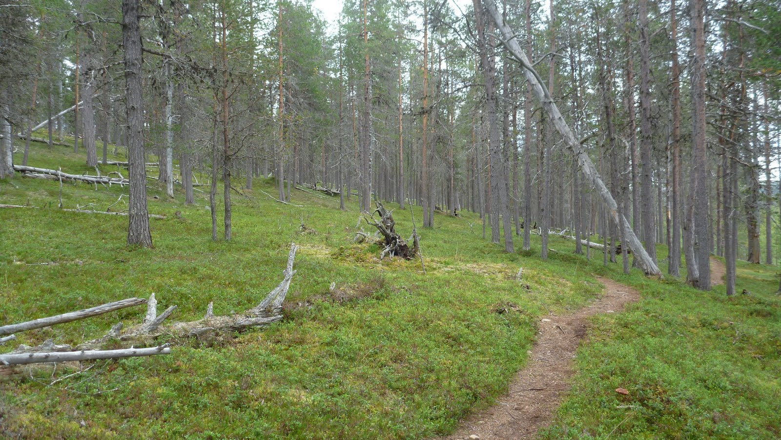
Planned route for our hiking on day 1 was quite short. However, the path started to rise and rise all of its way from the river and made walking more heavier. Scenery, although being all the way in the forest, was very nice.

After 1h 30min walk we arrived at the hut, called Kultala, along a small Morgamoja stream. There were actually two parts in the hut, one (for a rent) for pre-booked ones and another one open for everyone following first-in rule. Proudly owning the key to the pre-booked part of the hut, it was now reserved only for us. There was also a small Sauna hut, which put other fellows on a cheered mode (they did exercise Sauna later in the evening, even dropping in the stream, water temperature was +9C).

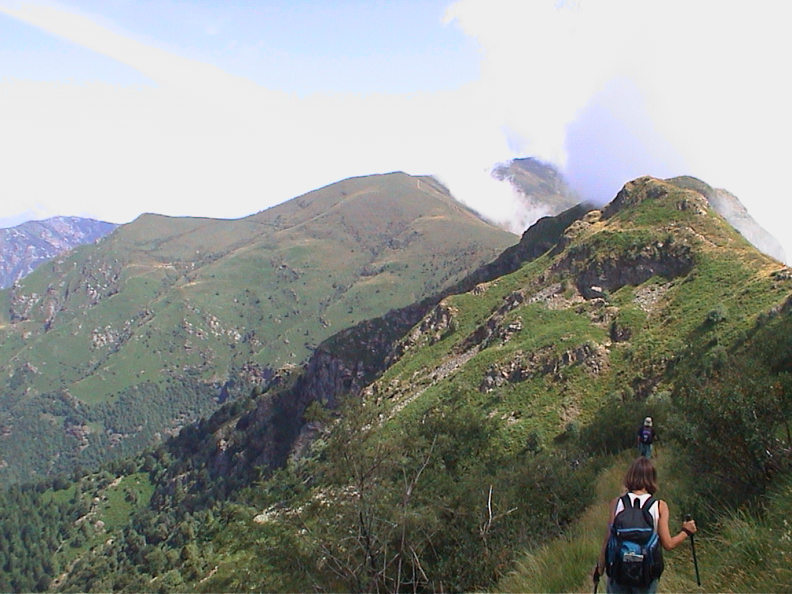
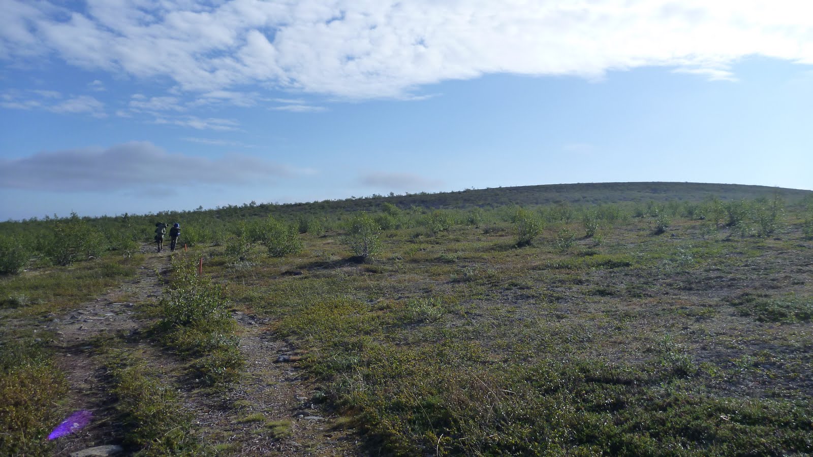
After some rest, we had one goal to achieve, i.e. find a geocache hidden on Petronellan Kukkulat Fell near by the hut.  Although summit of the fells often are quite flat, 360 degrees view from the summit was astonishing.  After this, an early dinner put us into deep sleep.

Hiking distance of day 1 was about 8km. The weather stayed rather cloudy the whole day, temperature around +15C.


A local taxi transferring hikers to Natural Park and Gold Mining region

Geocaching on Petronellan kukkulat Fells (better not to translate these...)

Route for Day 1:


Day 2

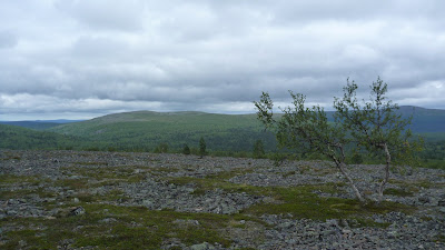
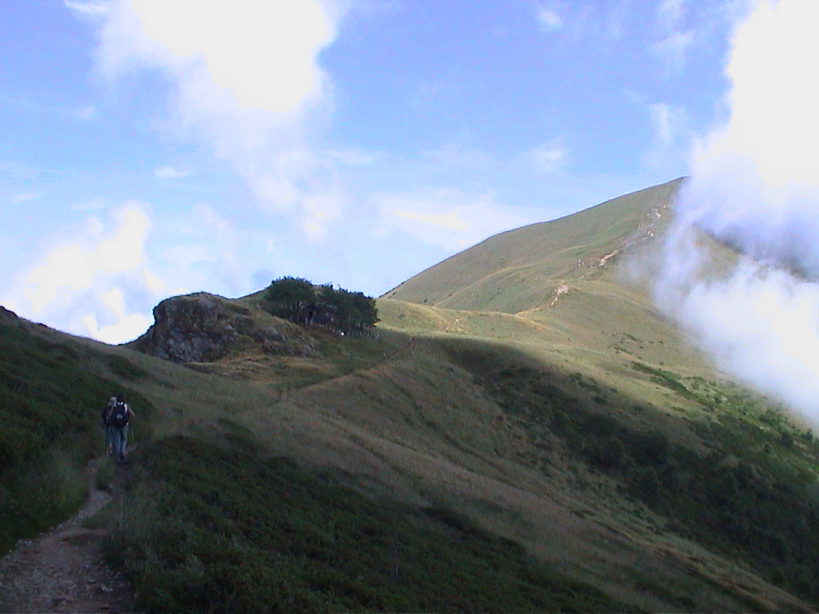
Early breakfast and off we went.  Clear blue sky and the sun was shining. Started to climb to first fell, Pellisenlaki (the fell named according to a man called Pellinen, a famous gold miner some 50 years ago).

The large area of the summit was treeless and the scenery really beautiful. A young family walked towards us and were heading to the boat. Had a short chat with them. The man appeared to be a gold miner (gold digging season approx. from June to September). Lots of reindeers looking for things to eat were wandering on the summit, too.

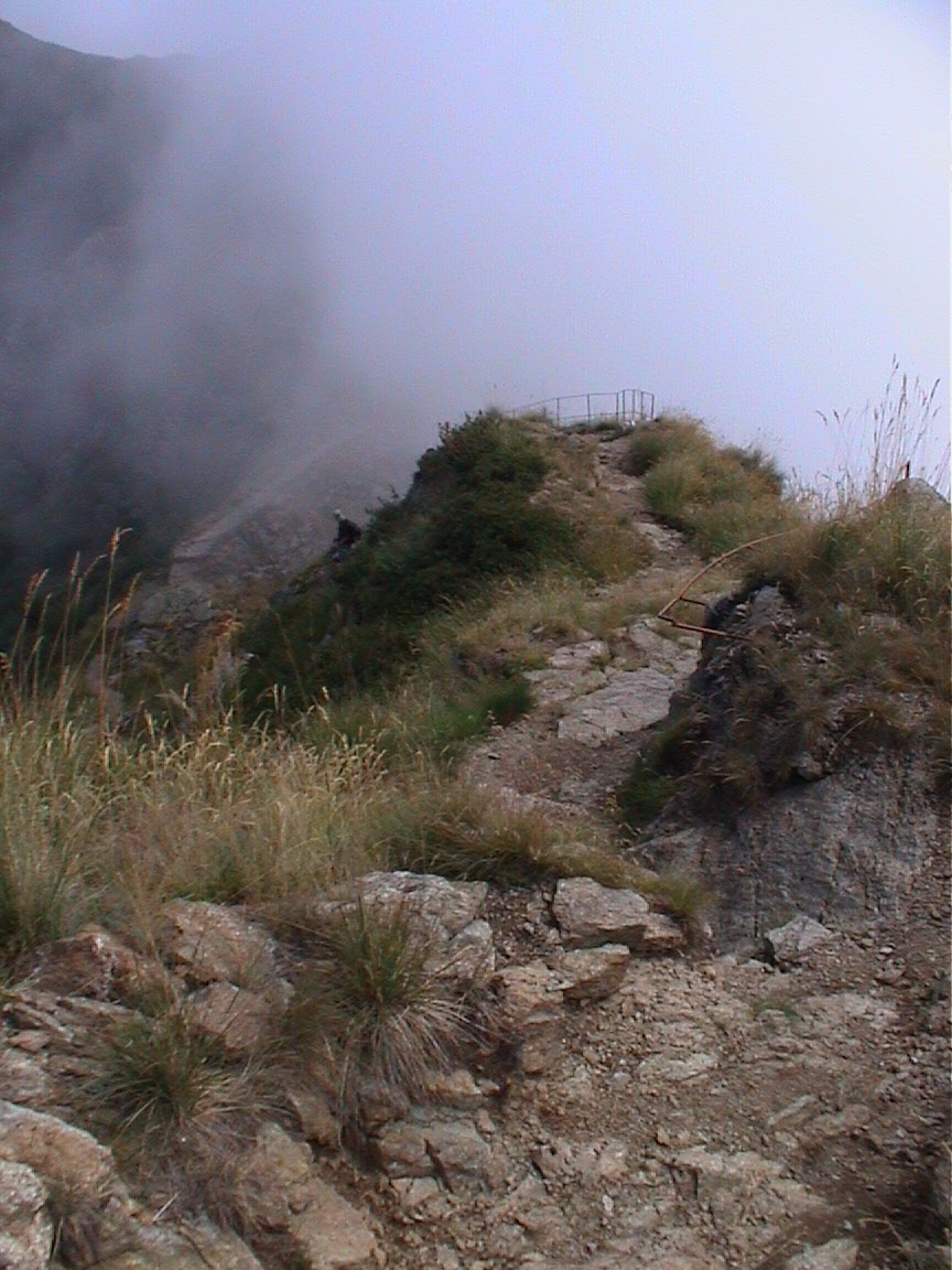
After passing the summit of the Pellisenlaki fell, the path started to go slightly downhill but soon again started to rise to top of the next fell, Gaskoaivi (the name sounds very Sami language).

From the summit of the Gaskoaivi fell, when looking to the north direction, one could see several huts of the gold miners as well as some machinery which you heard making the noise. Unfortunately they were in such far in distance that we decided to continue our hike and not to visit them.

As we noticed that the path started to drop a lot after the summit, we decided to have a lunch break on the summit thus able to enjoy the scenery.

After the lunch break the path went downwards and hiking became easier. The nature changed as well when we went more and more down, first start to appear trees then some small streams. Lots of shots with a camera.

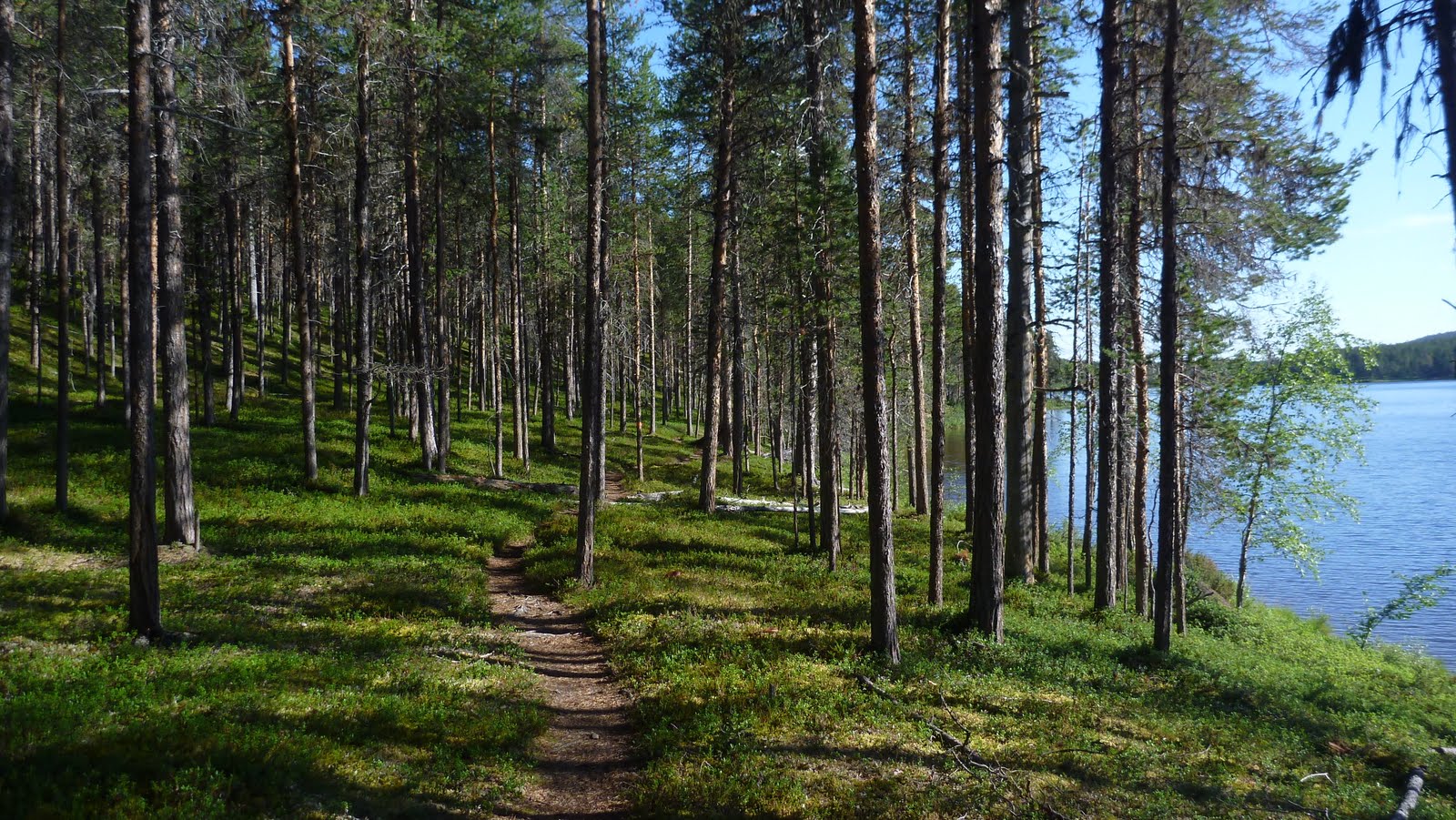
Once we reached the Ravadas river, the path went to more into the forest, quite different though. The forest looked more like a maintained park rather than a forest in natural condition. Here and there were dead fallen trees, gray colored, making a nice contrast to green colored surface of the ground.

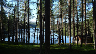
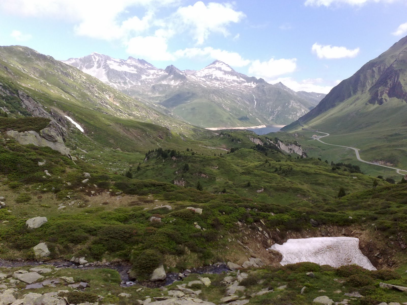
The path continued downhill following the Ravadas river all the way until the Ravadasjärvi hut along the Lemmenjoki river.  This hut was open to all hikers. As we were the first ones, were able to choose the place. During the evening more and more hikers came to the hut staying overnight there, some stayed in their tent.

The hiking route from Kultala hut to Ravadasjärvi hut was mostly downhill and contained the best scenery that we came across.

Two fellows went to swim, water temperature was about +12C. Otherwise the rest of the evening was dedicated to eating lots of food.

Hiking distance of day 2 was about 15km. The weather stayed sunny in the morning and partly cloudy in the afternoon. The temperature was around +17C during the day time.


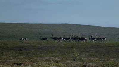
Reindeers on the summit of Pellisenlaki Fell

Summit of the Gaskoaivi Fell

I called this "The forest of the dead trees"

Crystal clear water in Ravadas River

The same as a short video clip:


Route for Day 2:


Day 3

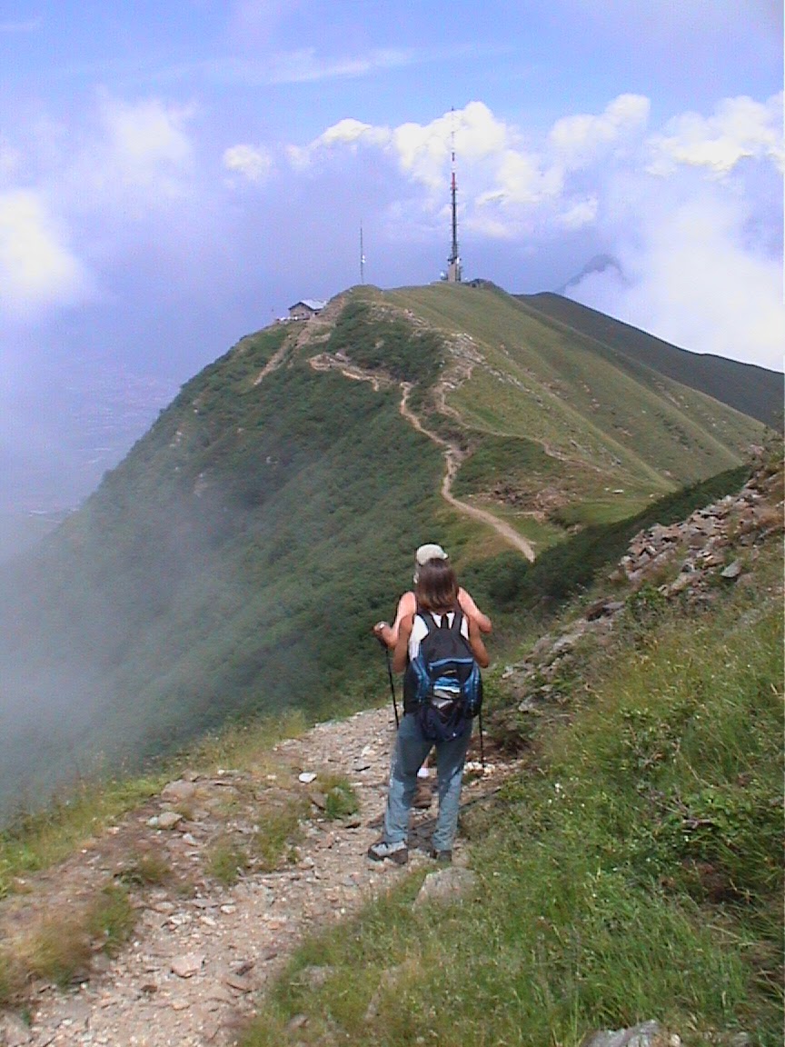
The morning was a bit more chilly than the day before. However, the sky was again out of clouds. Good breakfast and off we went again. Now the plan was to walk back to Ahkun Tupa cottage, following the hiking path (the path changed the side of the Lemmenjoki river at a half distance).

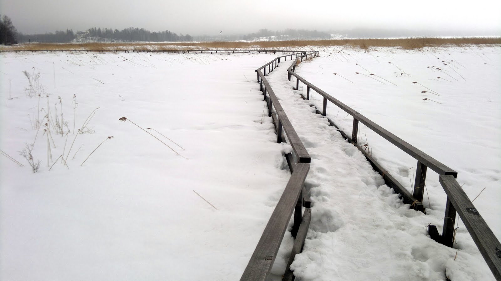
The hiking path followed the river, first on the shoulder of the river, then very near the shore. Two short breaks before the lunch break were justified due to beautiful nature and weather.  The lunch break came near the place where one was able to cross the Lemmenjoki river (as there were no bridges in the river).

Crossing the river was provided by a self-serviced boat and thus made fool proof easy. After crossing the river, the path started to rise towards the shoulder, now much higher than on the other side earlier. At the same time the nature changed again, this time there started to be much more pine trees.

After several hours we arrived at Ahkun Tupa cottage (where we had rent a hut). Shower, clean clothes and a dinner with Reindeer Stew and some beer crowned the day and made the end of the hiking trip.

Hiking distance of day 3 was about 17km. The weather stayed similar than the day before, sunny in the morning and partly cloudy in the afternoon. The temperature was around +15C during the day time.

Would I recommend this area for others who would be keen on hiking there?  Certainly yes. The treeless summit of the fells, almost park style of forests and crystal clear rivers make this area unique.

Early morning, Lemmenjoki River at Ravadasjärvi Lodge

Härkäkoski Lodge (for a rent)

Hiking path on shoulder of the Lemmenjoki River

Hiking path approaching the Lemmenjoki River

Self-service for crossing the Lemmenjoki River 

Screw anti-clockwise, why?

Erosion made by Tourists

Route for Day 3:


Epilogue

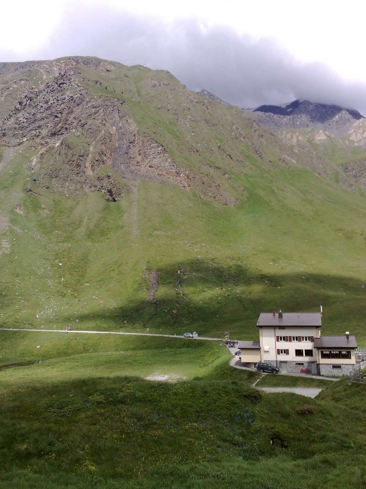
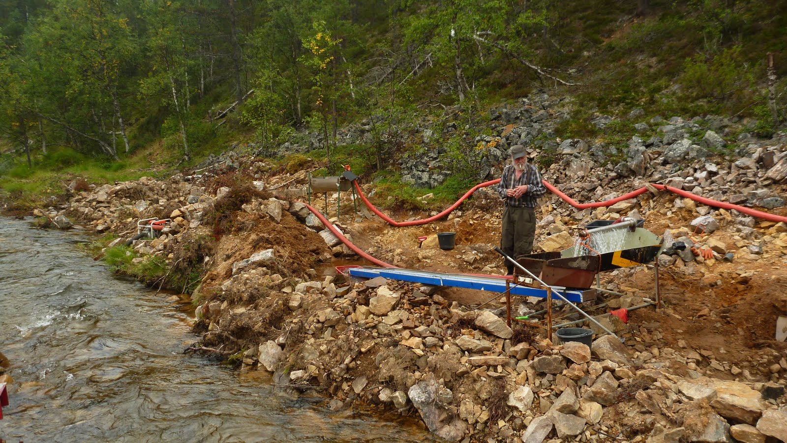
Well, what about our goal of seeing some gold mining in practice, and maybe trying it by ourselves?  We didn't spot any place so near the route, so we decided in the middle of the trip that we'd drive near Kiilopää fell, as we knew some people used to work there.  Fortunately we spotted one chap, who even let us to try digging. End result? We did find some very, very small pieces of gold, actually called gold dust and gave them to the owner.  Although not coming physically rich we became mentally rich; as you started to dig the earth full of stones and rock you realized that it was not just fun but hard work.


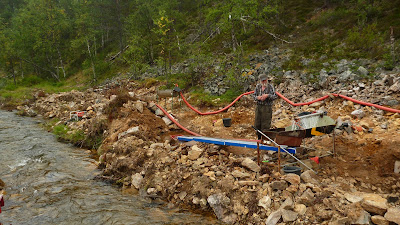
Searching gold and becoming rich - or is it just a way of life